About All Tours Moon Valley ToursBaltinache Lagoons ToursAstronomical ToursFrom San Pedro de AtacamaPrivate ToursUyuni Salt Flats Tours3 Day ToursGeyser del Tatio ToursPiedras Rojas & Lagoons Tours Directions Hours & Fees
Find Tours 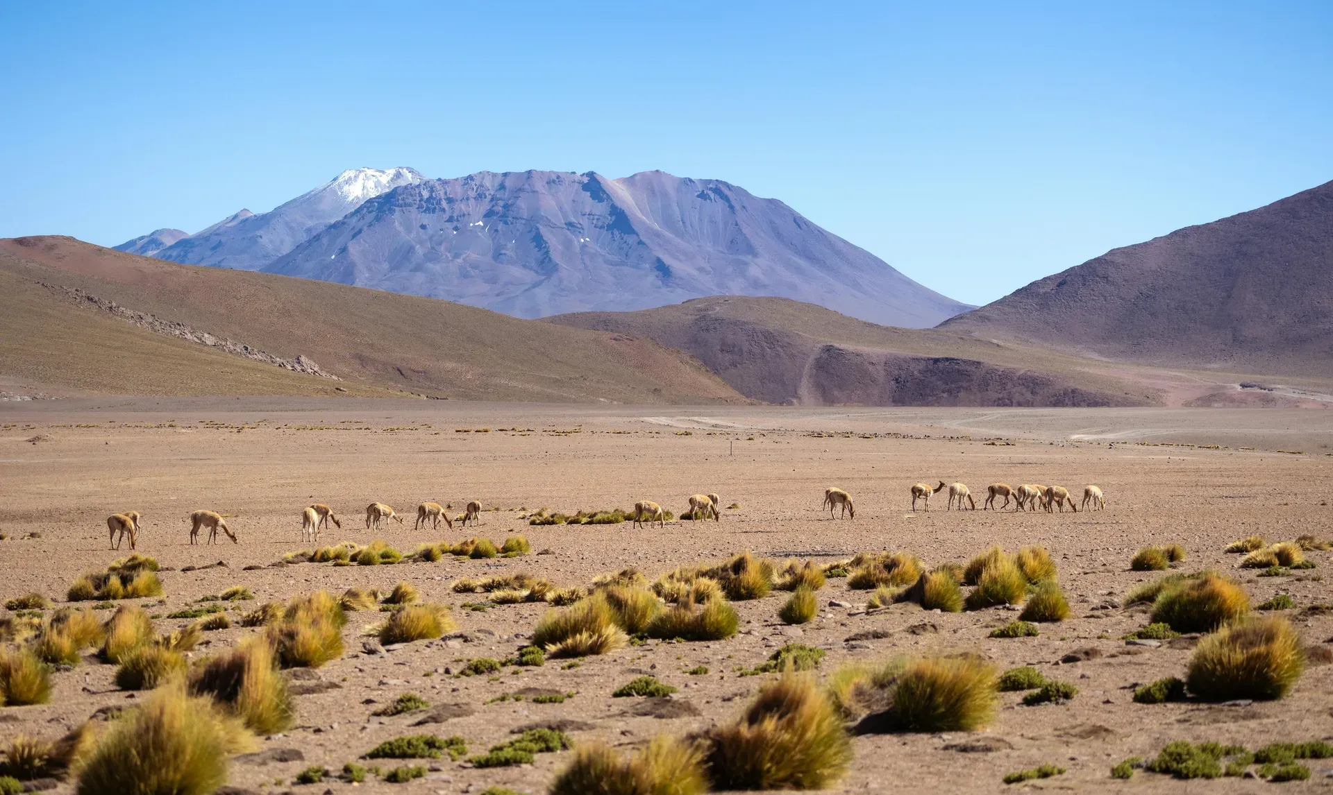
The Atacama Desert stretches 1,600 kilometers along Chile's Pacific coast. Extreme aridity and high altitudes create a Mars-like environment used for astronomical observation and space exploration testing.
A 1,600-kilometer plateau of salt pans, felsic lava, and sand dunes dominates northern Chile's Antofagasta region. The Atacama Desert holds the title of the driest non-polar environment on Earth. A two-sided rain shadow from the Andes Mountains to the east and the Chilean Coast Range to the west blocks precipitation from reaching the basin. The Humboldt Current cools the air above the Pacific Ocean, preventing marine moisture from forming rain clouds. This geographical trap restricts average annual rainfall to just 1 millimeter. Certain weather stations in the central sector have recorded zero precipitation for decades. The extreme aridity prevents glaciers from forming on the highest peaks. Ojos del Salado reaches 6,893 meters but remains entirely free of permanent ice.
Visitors face extreme environmental conditions immediately upon arrival. Daytime temperatures routinely hit 30°C under cloudless skies before plummeting to -15°C after sunset. The terrain sits at high elevations, requiring physiological adaptation. San Pedro de Atacama, the primary base camp for desert expeditions located 100 kilometers from the Calama airport, rests at 2,400 meters above sea level. Excursions to the El Tatio Geysers require ascending steep mountain passes to reach 4,320 meters. Thin air and intense ultraviolet radiation demand physical preparation. Altitude sickness poses a serious risk to travelers. Headaches, nausea, and dizziness frequently derail poorly planned itineraries.
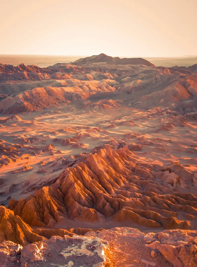
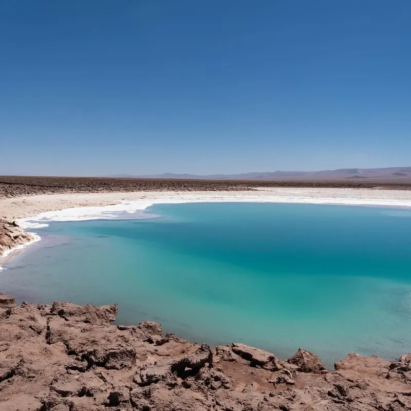
The landscape mirrors extraterrestrial environments. NASA tests planetary rovers and drilling equipment at the Yungay Station because the soil composition closely matches the surface of Mars. Travelers walk across the Cordillera de la Sal, where wind-carved salt crystals snap and crack under the changing temperatures. Laguna Cejar contains hypersaline water that forces human bodies to float effortlessly on the surface, mimicking the Dead Sea. Sudden flash floods during the January and February Altiplanic Winter wash out dirt roads without warning. Check the official CONAF website for daily park closures before driving into the desert.
Human survival in this arid zone dates back millennia. Coastal hunter-gatherers created the Chinchorro mummies around 7,020 BCE. These artificially preserved remains predate Egyptian mummification practices by thousands of years. The Chinchorro carefully removed internal organs, reinforced the skeletons with wooden sticks, and coated the bodies in black manganese or red ochre. Inland, the Atacameño, or Lican Antai people, established permanent settlements in the river oases around 500 BCE. They engineered advanced irrigation canals and terrace farming systems to cultivate maize, quinoa, squash, and alfalfa for livestock in an unforgiving environment.
Industrial interests violently transformed the region in the late 19th century. Massive deposits of sodium nitrate, known as saltpeter, lay beneath the desert crust. This valuable resource fueled the global production of explosives and agricultural fertilizers. Control over these deposits triggered the War of the Pacific from 1879 to 1883. Chile fought against a military alliance of Bolivia and Peru. The Chilean army secured victory, annexing the entire Antofagasta region and permanently cutting off Bolivia's access to the Pacific Ocean. The borders established by the 1904 Treaty of Peace and Friendship remain in place today.
A massive mining boom followed the territorial conquest. Thousands of workers migrated to the desert to extract nitrate from the earth. Mining companies built over 170 sprawling company towns equipped with theaters, public markets, and extensive railway networks. The invention of synthetic nitrate in Germany during the 1910s collapsed the Chilean export industry overnight. By the 1930s, the mining corporations abandoned the settlements to the desert winds. Humberstone and Santa Laura stand today as UNESCO World Heritage ghost towns. Sand blows through roofless processing factories and empty worker barracks.
Modern economic activity centers on lithium extraction, astronomy, and international tourism. The Salar de Atacama holds nearly a third of the world's known lithium reserves. Massive brine pools evaporate under the desert sun, leaving behind the concentrated minerals needed for electric vehicle batteries. High altitudes and zero light pollution drew international space agencies to the plateau. The ALMA Observatory operates 66 radio antennas at 5,000 meters elevation on the Chajnantor plateau. Public tours run on weekends, requiring online reservations at least two months in advance.
Salt, sedimentary rock, and volcanic ash define the 105,000-square-kilometer basin. The Salar de Atacama spans 3,000 square kilometers, forming the third-largest salt flat on the planet. A thick crust of halite covers the surface, broken into jagged, polygonal ridges by thousands of years of extreme evaporation. Beneath this rough crust lies a subterranean brine rich in lithium, potassium, and magnesium. Three distinct species of flamingos—Andean, Chilean, and James—filter feed on microscopic brine shrimp in the shallow lagoon waters at the Chaxa National Reserve.
Volcanic activity violently shapes the eastern border along the Andes mountain range. The El Tatio geothermal field features 80 active geysers and hundreds of boiling mud pools. Boiling water erupts from the frozen ground at dawn, creating towering steam columns that reach 10 meters into the freezing morning air. Further south, the Valle de la Luna displays sedimentary rock formations carved by wind and ancient floodwaters. Iron oxide and other minerals stain the sand dunes and rocky outcrops deep red, purple, and stark white. Rainbow Valley, or Valle del Arcoíris, exposes tectonic uplift where green copper oxide, red clay, and white calcium carbonate form distinct stripes across the canyon walls. The Puritama Hot Springs offer a stark contrast to the dry rock, featuring eight natural pools of 33°C water flowing through a hidden volcanic ravine.
The atmosphere above the plateau remains completely devoid of moisture. Humidity levels frequently drop below 1 percent. This extreme dryness prevents cloud formation and atmospheric distortion, yielding more than 300 perfectly clear nights annually. The UV index regularly exceeds 11, requiring strict sun protection protocols. Stargazing relies heavily on this pristine visibility. Moonlight completely washes out the Milky Way and fainter constellations. Book astronomical tours during the new moon phase to see the Magellanic Clouds, Jupiter's moons, and Saturn's rings through high-powered professional telescopes.
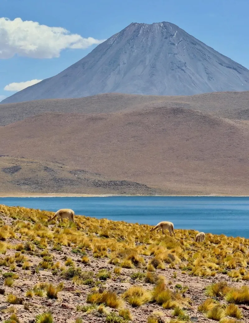
Indigenous cosmology treats the harsh landscape as a living, breathing entity. The Lican Antai people view the towering volcanoes, particularly Licancabur, as protective ancestors. This 5,916-meter stratovolcano dominates the skyline directly above San Pedro de Atacama. Pre-Inca priests climbed to its freezing crater lake to perform religious ceremonies and leave ceremonial offerings. Stone fortresses, like the 12th-century Pukará de Quitor, guard the strategic river valleys. Indigenous builders stacked unhewn ignimbrite stones to defend their agricultural settlements against invading Inca forces and, later, Spanish conquistadors led by Pedro de Valdivia in 1540. The indigenous Kunza language went extinct in the 20th century, but the vocabulary survives in the names of the surrounding mountains and salt flats.
Contemporary art and architecture directly reflect the extreme environment. The Mano del Desierto, an 11-meter-tall iron and cement sculpture, rises from the barren sand 75 kilometers south of Antofagasta. Chilean sculptor Mario Irarrázabal designed the giant hand in 1992 to represent human vulnerability, sorrow, and isolation in the vast expanse. In the desert towns, residents construct buildings entirely from local adobe. The historic San Pedro church, built in the 17th century, features walls of mud brick and a roof made of cactus wood tied together with leather straps. Thick mud bricks regulate the extreme temperature swings. The walls absorb intense solar heat during the blistering days and slowly release it into the rooms during the freezing nights.
Water scarcity dictates daily life and local environmental law. Protection regulations strictly limit human access to fragile ecological zones. Walking off marked trails destroys delicate salt crusts that take decades to naturally reform. Indigenous communities manage many of the altiplanic lagoons and hot springs directly. Carry enough physical Chilean Pesos for rural entrance gates, as these remote checkpoints lack cellular service and do not accept credit cards.
NASA uses Yungay Station to test Mars rovers because the soil composition closely matches the Martian surface.
The Chinchorro mummies date back to 7,020 BCE, making them thousands of years older than those found in Egypt.
Certain weather stations in the central desert have never recorded a single drop of rain since record-keeping began.
An 11-meter-tall cement hand sculpture emerges from the sand along the Pan-American Highway south of Antofagasta.
Despite being the driest desert, January and February bring violent thunderstorms and flash floods known as the Altiplanic Winter.
Three distinct species of flamingos survive in the hypersaline lagoons by filtering microscopic brine shrimp from the toxic water.
Visitors can travel from sea level to the 4,320-meter El Tatio geyser field in a single day, risking severe altitude sickness.
Tap water in the region contains high levels of naturally occurring arsenic and heavy minerals. Visitors must consume only bottled or filtered water. Brushing teeth with tap water is generally fine, but swallowing it causes severe stomach illness.
Spend at least 48 hours acclimatizing at the 2,400-meter base elevation of San Pedro before attempting higher excursions. Drink three to four liters of water daily and strictly avoid alcohol. Seek immediate medical attention if a headache is accompanied by vomiting.
The intense light of a full moon washes out the stars and the Milky Way. Tour operators frequently cancel or limit stargazing excursions during the three days before and after a full moon. Plan your trip during a new moon for optimal visibility.
A standard rental car easily reaches main sites like Valle de la Luna and Laguna Cejar. Excursions to the El Tatio Geysers or remote altiplanic lagoons require a high-clearance 4x4 vehicle. Deep sand and rocky tracks quickly trap low-clearance cars.
San Pedro de Atacama has several ATMs located along Caracoles Street. These machines frequently run out of cash during weekends and peak tourist seasons. Carry a backup supply of Chilean Pesos for rural entrance fees and small artisan shops.
Technical layering is mandatory for survival in the desert. Daytime temperatures reach 30°C, requiring lightweight, breathable clothing and heavy sun protection. Nighttime temperatures plummet to -15°C, demanding thermal base layers, heavy jackets, and gloves.
Drones are strictly prohibited in all National Parks and protected areas, including Valle de la Luna. Flying requires a specific permit from CONAF and the Chilean aviation authority (DGAC). Park rangers confiscate equipment from violators.
During January and February, moisture from the Amazon basin spills over the Andes mountains. This phenomenon causes rare but intense thunderstorms and flash floods. Desert roads wash out in minutes, forcing sudden closures of major tourist sites.
The extreme aridity prevents mosquitoes from breeding in most of the desert. Small populations exist near the Puritama Hot Springs and dense river oases. Bug repellent is rarely necessary outside of these specific wet zones.
The world's largest land-based observatory offers free public tours on Saturdays and Sundays. Access requires booking online through their official website two to three months in advance. Visitors tour the operations facility, not the high-altitude antenna array.
Browse verified tours with free cancellation and instant confirmation.
Find Tours